当前位置:网站首页>Visual thematic map of American airport go style: ArcGIS Pro version
Visual thematic map of American airport go style: ArcGIS Pro version
2022-07-25 10:44:00 【51CTO】
I did it yesterday ArcMap Version of the American airport go style thematic map , As a result, countless people in the company diss 了 …… Shrimp God ,9012 It's all coming to an end , You're still using ArcMap ah ! Are you an antique ? You let the masses use ArcGIS Pro What do your classmates think ?
Shrimp God said :

So I think it's still necessary to rectify the evil , Write a ArcGIS Pro Version of , Don't talk nonsense , Look at the effect :
A two-dimensional :
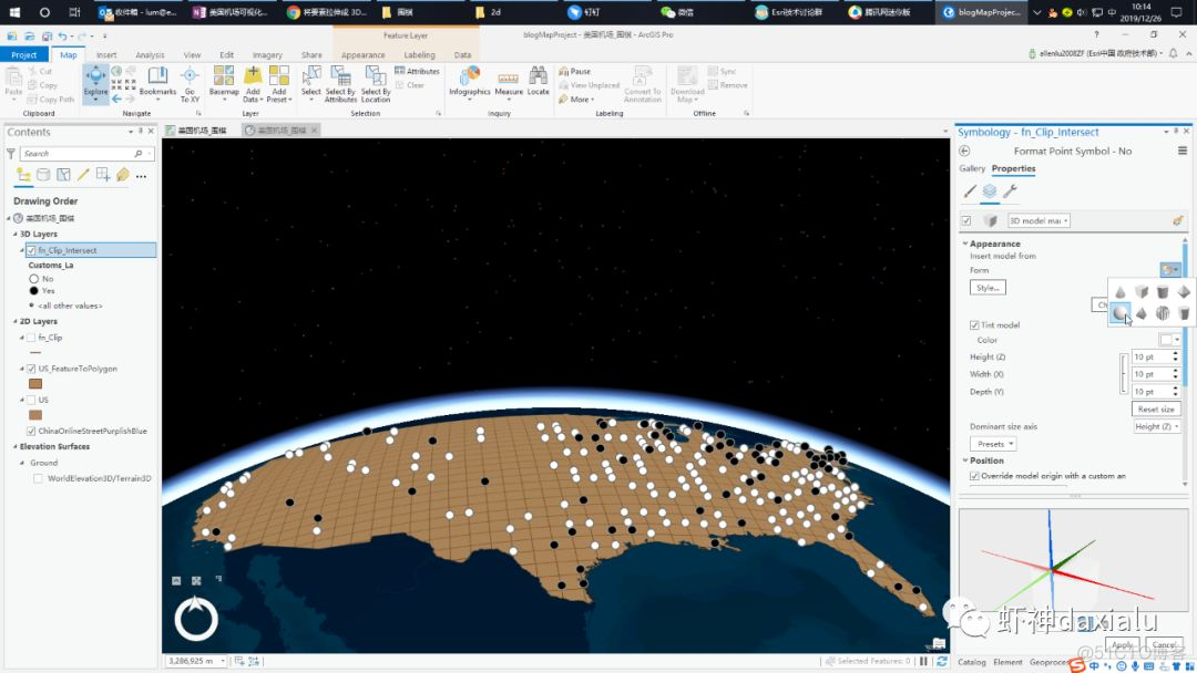
ArcGIS Pro Strong place , It's that he can make three-dimensional , as follows :

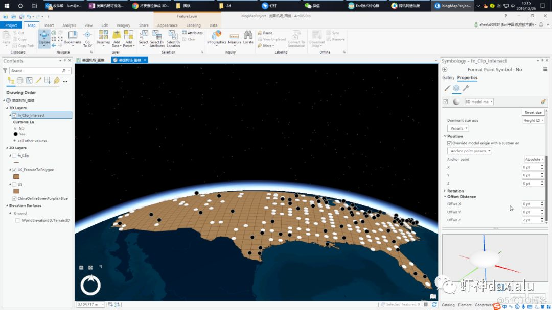
Then two-dimensional and three-dimensional integration , It's also his strong point :

So today, let's take a look at , How to be in ArcGIS Pro Make this kind of picture inside , It will actually use ArcMap Classmate , Basically, you can link seamlessly .
First, deal with the data :
After opening the data , First make a fishing net :

Parameters of fishing nets , And ArcMap The same as in China , The template selects the Native American region , Choose both width and height 10 Thousands of meters


After the net is finished , choice clip, Cut off the surplus


Select the intersection tool , Generate the intersection of the chessboard :


Then select the proximity analysis tool , Calculate the real airport location and the nearest intersection :


After coming out , Use the connection tool , Generate layer connections :

With intersection ID, With the airport NEAR_FID Make connections :

When the connection is complete , Select Properties —— Define query tab , Set the display conditions :
FID is not null

Then you can hide the extra points :

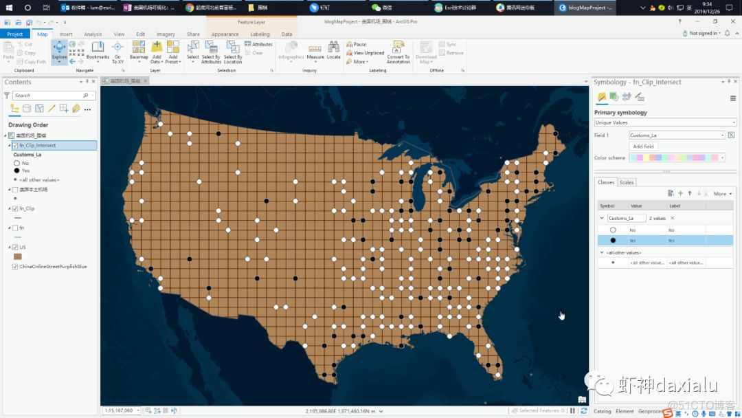
The next step is to set the color of the chessboard and chess pieces :


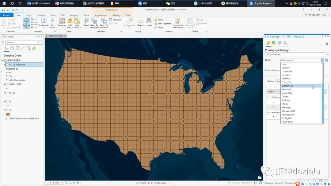
In the color setting of chess pieces , First choose a unique value to render :


And then choose customs_la Field ( Whether there is a customs entry Office ):
Set the size and color of the pieces :


Complete set
The two-dimensional part is finished ——
Here is the three-dimensional part :
First , stay ArcGIS Pro Create a new Global Scene Map This is a three-dimensional map used to show the global view :

A better habit is to change the name after construction , Otherwise, I won't find it next time :

For example, I'll call you away “ American airports _ go ”

Then go to the original two-dimensional map , Select the data we process , Copy —— Paste the Scene Go inside the map :


When pasting , It will automatically put these layers into 2d Layers Inside , From the view , Can see , Our chessboard line is deformed :

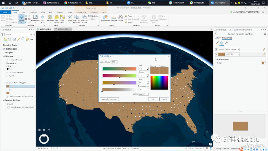
Why does this happen ? Because of the map projection , Produced deformation ( Students majoring in geography are invited to review the fundamentals of Geodesy )…… Now let's do a treatment , Deal with this deformation , The plan is to merge the chessboard line and the map of the United States , The processing tool is Elements turn to face :

After opening the feature face tool , Load the map of the United States and the checkerboard line , Click on the run , Get a divided map of the United States : This method can also be used to cut face elements ——
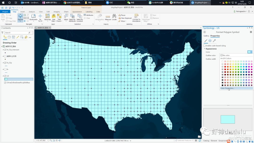
It's the same after that , Configure the color of the chessboard , Be careful , There is only one layer left , So the fill color is the color of the chessboard , The sideline is the color of the route :

After setting up , We begin to set up chess pieces : Here, set the chess pieces as three-dimensional , What you need to do is put the layer of the chess pieces , from 2d layers Drag it directly to 3d layers Inside , That's all right. :

I found that after dragging here , It becomes a ball :


Next, set the effect of chess pieces , Click on the white chess piece , Then in the attribute , choice 3d model masker

Then choose ball :
stay tint model Inside , Set the shape of the chess piece : First of all, put xyz The connection line of is cancelled , Otherwise, linkage will be carried out :

After adjustment xyz Value , Because go pieces are usually flat , So choose xy by 12pt,z by 6pt

Set the pieces to stick to the chessboard , So set offset distance Medium z by -6 pt

Click application , Baizi is set .
Next, use the same method to set sunspots :


After all settings are completed , Finish the 3D effect :
Then you can pose, take photos and send a circle of friends :
Last words :ArcGIS Pro It's still very easy to use , You can go through Esri Apply for 21 Days of free trial , If you are a student or teacher in school , You can contact your local Esri The education sales manager of applied for a one-year probation .
Of course , You can also buy ArcGIS Pro Personal version of —— Only a few hundred yuan a year , Relevant sales methods , Please also contact the local Esri Industry sales manager .
Last , Or release the data download address :
1、 Follow shrimp God official account : Shrimp God daxialu

Then send a message on the official account “ American airports ”, Download address available :

PS: This reminder , It is superfluous for the iron powder of shrimp God , Because the old irons naturally know where to go to pull all kinds of data provided by the shrimp God , Mainly new fans and classmates who saw this article in other channels , You can get it by following the official account .
边栏推荐
- 湖仓一体电商项目(二):项目使用技术及版本和基础环境准备
- 8.shell文件处理三剑客之sed
- 2. Introduce the deployment of lamp platform +discuz Forum
- Add CONDA virtual environment env to the Jupiter kernel
- 3.跟你思想一样DNS域名解析服务!!!
- 7. Shell practical gadget cut, etc
- 6.shell之正则表达式
- Test plan and test plan
- Storage, computing, distributed Virtualization (collection and sorting is suitable for Xiaobai)
- Microwave technology homework course design - Discrete capacitance and inductance + microstrip single stub + microstrip double stub
猜你喜欢
![[strategic mode] like Zhugeliang's brocade bag](/img/c8/4baeabbc3674b956f6d376ab71e15a.png)


随机推荐
我为OpenHarmony 写代码,战“码”先锋第二期正式开启!
Notes on building dompteur container
ONNX(Open Neural Network Exchange)介绍
Introduction to onnx (open neural network exchange)
推荐系统-协同过滤在Spark中的实现
Software test notes, test case design
HCIP实验(02)
Wechat applet wxprase contains files that cannot be solved by clicking
Pytorch tensor list is converted to tensor list of tensor to tensor using torch.stack()
C# 类库的生成,使用类库对象对DataGridView 进行数据绑定
微信小程序WxPrase中包含文件无法点击解决
Hucang integrated e-commerce project (II): project use technology, version and basic environment preparation
js 哈希表 02
ONNX Runtime介绍
4.FTP服务配置与原理
Pytoch separates tensor by the value of one dimension of tensor (simple)
Bug classification and grading
使用px2rem不生效
3.跟你思想一样DNS域名解析服务!!!
Angr (IV) -- angr_ ctf