当前位置:网站首页>Road vector data download tutorial
Road vector data download tutorial
2022-06-24 18:41:00 【Geographical space of ruiduobao】
Road vector data is the basic geographic information data , I sorted out several common methods for downloading road vector data .
NASA Road data
Global Roads Open Access Data Set yes NASA A global road data set based on the United Nations spatial data infrastructure transport common data . Many countries have edited this data set , The data time range ranges from 1980 S to 2010 Different years ( It depends on the country ), In addition, the spatial accuracy of the data set varies from country to country .

Download the data , Go to the website :https://sedac.ciesin.columbia.edu/data/set/groads-global-roads-open-access-v1/data-download

Slide the page to the bottom of the page , There will be a link to download road data by continent :

We click to download the road data of Asia , Click download and a login box will appear , Click on login Sign in NASA. If you don't have an account , You can use the public account I created :ruiduobao Account and password :Ruiduobao123

After downloading the data , Unzip and view the data . You can use if you can Google The accuracy of image viewing road data . It looks good at first glance .

But actually zoom in , We loaded it into Chengdu , The data is obviously insufficient :

National Public Edition of basic geographic data
Geographic information professional knowledge service system is the data download website of Chinese Academy of engineering , The website provides information about 1:25 Million road data :

First go to the website :http://kmap.ckcest.cn, Select the whole country DLG data :

According to personal needs , Select the region data to download , We need to pay attention to : The database does not contain road data for all regions , therefore It depends on luck . Here's what I downloaded 2015 Road data of Chengdu in :

Click to download , You need to log in . If you don't have an account , You need to register an account :

Then return to the data download interface , Look at the data information before downloading .

Click data download on the page , After downloading . You can use if you can Google Image view road data :

Pay attention to , This data has been Confidential technology processing , So the data is offset , This data is for reference only .
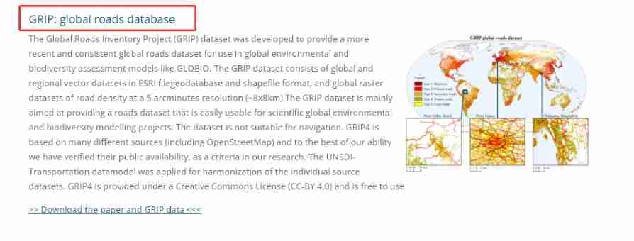
GRIP Global Roads
GRIP The dataset is Dutch GLOBIO Global road integration data produced by the team based on many different road data , It aims to provide road data sets for global environmental and biodiversity research projects , The data set consists of global vector road data set and 8km The resolution road density raster dataset consists of two parts .

The download website is :www.globio.info, After entering the website, select Resource, Re selection Datasets

Find road data in the dataset , Click to enter :
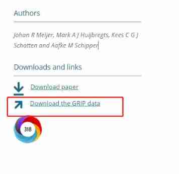
After entering the interface , Click on Download the GRIP data:
Select the corresponding area to download data , If you are downloading Chinese data , choice South and East Asia:

After data download , Load into GIS View... In the software :

Geographic data platform of Peking University
Geographic data platform of Peking University , School of city and environment, Peking University 2017 established . The purpose of the platform is to serve the students of our college and geography major 、 Teachers and researchers provide comprehensive 、 Enrich 、 Professional data information , Trying to build a platform for geographic data sharing and exchange , Build a database that describes the earth system from different directions . Road data of the platform Only teachers and students of Peking University Downloadable :

Download url :https://geodata.pku.edu.cn/index.php?c=content&a=show&id=713

OSM data
OpenStreetMap( abbreviation OSM) It's an online map collaboration program , The goal is to create a world map that is free of content and can be edited by everyone . The data of the platform can be downloaded freely .

download OSM Road data for , With the help of third-party platforms . The website is :https://extract.bbbike.org Open the link , Move the map to the area to be downloaded :

stay format Select download format in , General choice shp Data is enough :

Then fill in the basic information , The email address shall be correct :

Click on here, Check the download area . This area can be through add ponits to polygon Make changes . After confirming the scope , Click on extract:

After that, your email will receive a download link containing all vector data in the region , Click on the link to download :

Unzip the downloaded data , Find road data roads:

Load data into gis In the software :

About OSM data , I recorded a download and use video , You can have a look at what you are interested in :
welfare

OSM National road data 、NASA Road data 、GRIP Road data has been uploaded to Remote sensing Forum (ruiduobao.com), Please pick it up by yourself :

View more data tutorials , Welcome to the geoscience remote sensing data collection (www.gisrsdata.com):
Reference resources
Columbia University .https://sedac.ciesin.columbia.edu/data/set/groads-global-roads-open-access-v1
Geographic information professional knowledge service system .http://kmap.ckcest.cn
Globio.https://www.globio.info/download-grip-dataset
Little ape Giser.https://mp.weixin.qq.com/s/zs9rkAeMeTsEDpAXerJ3TQ
Geographic data platform of Peking University .https://geodata.pku.edu.cn
边栏推荐
- Microservice system design - sub service project construction
- congratulate! The first dragon lizard community annual outstanding contribution award is announced. Check it now
- 【leetcode】838. Push domino (Analog)
- Leetcode question 136 [single number]
- Exception: Gradle task assembleDebug failed with exit code 1
- Usage of typedef enum (enumeration)
- Application service access configuration parameters
- Self taught C special data type
- Keep two decimal places
- What makes data analysts good- Cassie Kozyrkov
猜你喜欢

How to use Fisher's least significant difference (LSD) in R

Wechat applet development - Implementation of rotation chart

Leetcode weekly buckle 281

How MySQL works - Chapter 14

Microservice system design -- interface document management design

Window object
![subject may not be empty [subject-empty]](/img/6b/9b57a7ed3ab086036cb6dfe0b31de4.png)
subject may not be empty [subject-empty]

About pyqt5 to realize paging function (one window implements different interfaces)

Eight digit
[quick news] the jeecgboot low code platform was successfully selected into the 2021 scientific innovation China · open source innovation list
![[quick news] the jeecgboot low code platform was successfully selected into the 2021 scientific innovation China · open source innovation list](/img/1a/c148d02eb7d58a15c92a91b6cdefc4)
随机推荐
Leetcode daily question solution: 717 1-bit and 2-bit characters - reverse order
Sword finger offer 10- ii Frog jumping on steps
微服務系統設計——子服務項目構建
Redpacketframe and openmode packages
In depth learning of movement methods
Three indicators to help you measure the effectiveness of digital transformation
How MySQL works - Chapter 14
时间溯源的系统设计思路
解读HarmonyOS 应用与服务生态
如何在 R 中创建线性模型预测区间 并可视化
Recommend a distributed JVM monitoring tool, which is very practical!
About whether arm's large and small end mode is related to CPU or compiler
JS local storage
About pyqt5 to realize paging function (one window implements different interfaces)
Leetcode skimming questions - the 72nd biweekly match and 281 weekly match
Nacos cluster starts throwing set of SQL_ SELECT_ LIMIT is not support
Bigdecimalavoiddoubleconstructorrule: do not directly use the double variable as a parameter to construct BigDecimal
The mixed calculation of rpx and PX in JS by the uniapp applet
Bisection function template
Leetcode weekly buckle 281